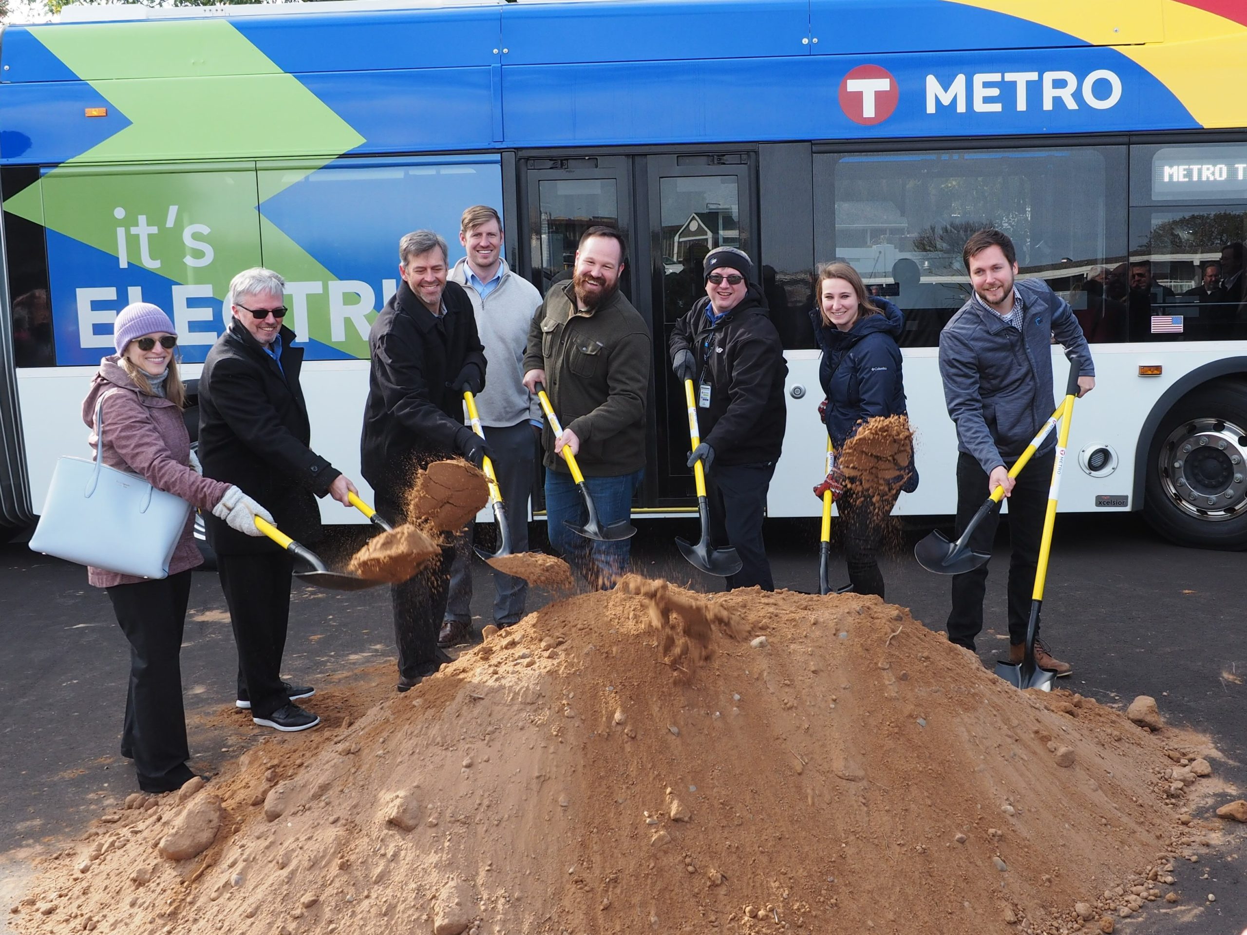
The METRO Gold Line Bus Rapid Transit (GBRT) provides bus rapid transit service from downtown Saint Paul near the Xcel Energy Center to the I-494-Woodbury Park & Ride facility in Woodbury. As a key partner in the comprehensive project’s consultant team, SRF led the water resources effort, structural design, relocation services, and construction administration for the project. SRF also led the transitway design, urban design, and roadway design effort for the Saint Paul portion of the corridor and various elements of the environmental planning and documentation process for the entire corridor.
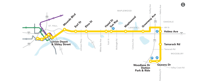
The project corridor consists of 7 miles of dedicated guideway and 4 miles of mixed traffic roadways primarily following the I-94 and Bielenberg Drive corridors through the cities of Saint Paul, Maplewood, Landfall, Oakdale, and Woodbury. The project also constructed/reconstructed impacted roadways, station areas, pedestrian and bicycle access ways, and park-and-ride facilities. It is the first BRT in Minnesota that operates primarily within bus-only lanes.
Washington County, Ramsey County, Metropolitan Council, Metro Transit
Minnesota
Bridges and StructuresConstruction Administration and Project Delivery
Roadways
Streetscape & Urban Design
Traffic and Technologies
Transit
Urban Design
Water and Environment View All Projects
Draft Environmental Assessment
SRF played a critical role in completing the METRO Gold Line (Gateway Corridor) Draft Environmental Assessment. SRF assisted partners in selecting a locally preferred alternative (LPA) for inclusion in the Metropolitan Council’s long-range transportation policy plan, developed engineering concepts for the corridor, and completed environmental assessment documents required for the project to advance under state and federal environmental requirements. SRF was also instrumental in preparing the social impacts portion of the EA, addressing land use, community impacts, and environmental justice.
Concept Design
SRF developed design concepts for the eastern portion of the corridor, which was challenged by very limited right of way, proximity to the Dayton’s Bluff historic district, and difficult topographical relationships between the dedicated guideway and adjacent I-94 corridor. These conditions required a thorough examination of a range of options, including freeway BRT; on-line, in-line and off-line station locations; interchange modifications; and local street options to balance neighborhood impacts, transit access, and freeway operations. SRF also provided ridership modeling for the corridor, including ridership estimates for both the Gold Line and express bus service in the corridor.
SRF prepared a Health Impact Assessment (HIA), identifying potential health benefits to be gained by promoting transit use and more active transport options in the corridor. The SRF team also prepared high-level preliminary station area plans that introduced the corridor cities to transit-oriented development principles and regional development requirements. In addition, SRF assisted Washington County with public engagement tasks, including managing the Community Advisory Committee and Policy Advisory Committee and providing strategic advice regarding agency relationships and the FTA New Starts process.
Urban Design
SRF coordinated and designed station locations within the downtown environment using an “outside-in” design approach to seamlessly integrate stations into busy pedestrian routes, building entrances, historic facades, light poles, and underground. The downtown station designs also included green infrastructure areas to treat stormwater. For the neighborhood roadway and station design, SRF applied the same “outside-in approach” to minimize right-of-way impacts while enhancing pedestrian and bicycle connectivity by extending walks and trails into the surrounding areas.
Transit Design
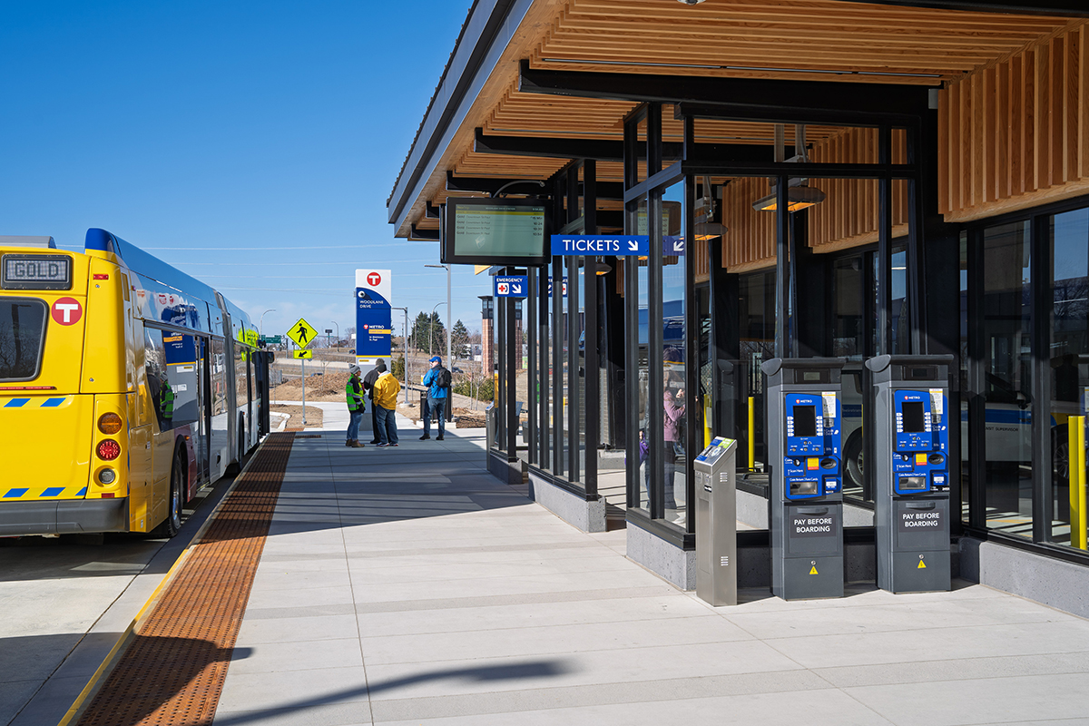
SRF’s urban mobility design team coordinated with the City of Saint Paul and MnDOT on the design of approximately 4.5 lane miles of concrete transitway, 120+ ADA-compliant pedestrian ramps, approximately 1.5 miles of new trails, nearly 2 miles of reconstructed city streets, and two major I-94 and TH-61 ramp realignments. Eight full-amenity BRT stations in the heart of downtown Saint Paul and three suburban stations were incorporated into this segment.
Water Resources
The impacts from new and reconstructed impervious surfaces triggered requirements of several regulatory agencies relating to water quality treatment, stormwater discharge rate control, and floodplain management. The project corridor’s stormwater management plan identified best management practices (BMPs) that provide water quality treatment, rate control, and volume reduction to offset impacts from additional impervious surface.
BMPs were chosen based on discussions during the Stormwater Issue Resolution Team (IRT) process that SRF facilitated, review of applicable BMPs via the project’s BMP Toolbox, and a survey of various project partners, including coordination with municipalities, watershed districts, and MnDOT. The final stormwater management plan includes 35 BMPs providing over 10+ acre-feet of water quality volume, more than 30 pollutant control devices, over 1,200 drainage structures, and more than 13 miles of storm sewer pipes.
Bridge Design
SRF’s structures team led the overall project structural design effort which included 12 bridges, 43 retaining walls, nine noise walls and various other minor structures. SRF’s bridge work included a unique pedestrian crossing at Maple Street that upgraded the existing crossing to an ADA compliant one. The project also pushed the limits for prestressed concrete beam structures at the BRT crossing of TH 61 with one of the first projects to utilize the new 96MW shape with spans approaching 200 feet. SRF staff worked with project partners to address the many challenges of fitting the new infrastructure into an already very tight corridor with varying structural and geotechnical demands.
Traffic Analysis and Signal Design
SRF completed the traffic analysis for the Gold Line BRT in Saint Paul, which included all signalized intersections. This work included both Syncro/Sim-Traffic and Vissim analysis depending on the needs of specific locations and mitigations were identified for intersections where the BRT was expected to impact intersection operations.
SRF’s traffic signal team prepared traffic signal plans for eight signals as well as signing and striping plans. This included complex intersection phasing, coordination with numerous stakeholders and subconsultants, and careful consideration of pedestrian needs.