Civil engineering is the design, construction, and maintenance of the physical infrastructure that surrounds us. It encompasses everything from bridges and roads to dams and wastewater systems, with the overarching goal of creating safe, efficient, and sustainable structures and systems.
Technology has played a pivotal role in transforming traditional construction processes into more efficient and precise endeavors. By embracing modern technology, civil engineers are equipped to tackle complex challenges, optimize resource utilization, and envision infrastructure that aligns with the needs of our rapidly changing world.
These innovative solutions and digital advancements have become the driving force behind modern civil engineering practices, from the integration of drones to the power of 3D modeling.
Drones in Civil Engineering
Drones, also known as unmanned aerial vehicles (UAVs), are remotely controlled aircrafts equipped with advanced sensors, cameras, and data processing capabilities. Below is an overview of the diverse range of drones specially designed to carry out essential tasks for construction projects:
Mapping and Surveying Drones: These drones are equipped with high-resolution cameras and advanced mapping software, making them ideal for capturing topographical data, creating 3D models, and conducting land surveys. They are instrumental in the initial phases of project planning and site assessment.
Inspection Drones: Inspection drones are designed to closely examine structures, such as bridges, buildings, and pipelines. Equipped with specialized sensors, including thermal cameras and light detection and ranging (LiDAR) scanners, they can detect defects, cracks, and structural issues, facilitating maintenance and safety assessments.
Photography and Videography Drones: These drones are equipped with high-quality cameras and are often used for monitoring progress and producing visual documentation of projects. They also serve as valuable marketing tools by capturing breathtaking aerial images and videos of construction projects.
Surveillance Drones: Drones used for safety and security are equipped with high-resolution cameras, thermal imaging systems, and night vision capabilities. They are used to monitor and survey critical infrastructure, construction sites, and sensitive areas, ensuring that potential security threats or safety hazards are promptly detected and addressed.
Delivery Drones: Although less common in civil engineering, delivery drones are designed to transport small payloads of materials or equipment to remote or challenging-to-access locations on construction sites. They have the potential to streamline supply chain logistics in some scenarios.
Digital Design Plan Delivery in Civil Engineering
Traditionally, civil engineering projects heavily relied on paper-based plans. However, digital design plan delivery replaces these conventional documents with cutting-edge technologies – enabling the creation, management, and sharing of comprehensive project designs and plans using digital tools. Here’s how technology enhances and streamlines the design plan workflow:
Accuracy and Consistency: Digital design plans are created using computer-aided design (CAD) software, ensuring precision and consistency in every detail. This precision not only reduces design-related errors but also minimizes the likelihood of on-site adjustments during construction.
Accessibility and Collaboration: Digital plans are easily accessible to all project stakeholders through secure online platforms. Engineers, contractors, architects, and other key players can engage in real-time collaboration, fostering improved communication and coordination.
Version Control: Digital design plans enable efficient version control. Changes can be tracked, documented, and communicated seamlessly, reducing the risk of working with outdated information. Version control also simplifies the process of identifying who made specific changes, aiding accountability and transparency within the project team.
Sustainability: Beyond their practical benefits, digital design plans also align with sustainability goals. The move away from traditional paper-based plans significantly reduces paper consumption, saving countless trees and reducing the environmental footprint of civil engineering projects.
Enhanced Visualization: Many digital plans incorporate 3D modeling and visualization tools, providing a more comprehensive understanding of the project’s scope and design intent. This immersive experience allows for better-informed decisions and creative problem-solving.
Regulatory Compliance: The ease with which digital design plans can be submitted to regulatory agencies has streamlined the approval and permitting process. The digital format allows for faster and more efficient review and approval procedures. Agencies can access and assess plans remotely, expediting the regulatory phase and helping projects progress smoothly through various approval stages.
Time and Cost Savings: Streamlined workflows, reduced printing, and distribution costs translate into significant time and financial savings for projects. With more efficient processes in place, projects can allocate resources to other critical aspects while ensuring they remain on schedule and within budget.
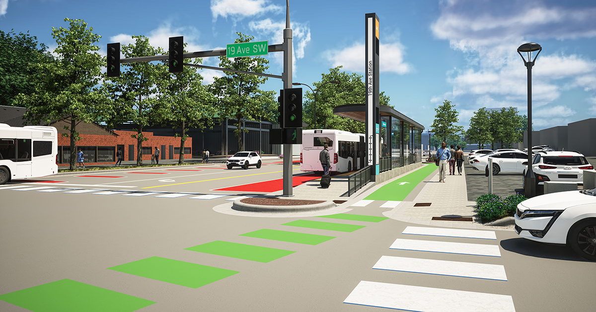
3D Modeling in Civil Engineering
At its core, 3D modeling in civil engineering is the creation of three-dimensional digital representations of physical objects, structures, or entire landscapes. This technology introduces depth and realism to the design and visualization process, offering a comprehensive view of projects from multiple angles. The process of 3D modeling in civil engineering involves a combination of cutting-edge software, data input, and advanced visualization techniques. Here’s an overview of how it works:
- Data Acquisition: The journey begins with data collection. Engineers and surveyors employ various methods such as laser scanning, aerial surveys, ground-based surveys, or photogrammetry to gather precise data about the physical object or environment to be modeled.
- Point Cloud Generation: Often, data is initially captured in the form of a point cloud. This comprises a vast collection of individual data points meticulously recorded in three-dimensional space. Technologies like LiDAR scanners and GPS play a pivotal role in generating these point clouds.
- Data Processing: The point cloud data undergoes processing using specialized software. This software aligns, organizes, and transforms the raw data points into a cohesive dataset suitable for modeling.
- 3D Modeling: Armed with the processed data, engineers and designers utilize CAD software or dedicated 3D modeling applications. They create digital renditions of the physical object or environment, specifying shapes, surfaces, textures, and materials with precision and attention to detail.
- Visualization: The completed 3D model can be visualized from a multitude of angles and perspectives. This interactive and immersive representation allows stakeholders to grasp the design’s intricacies and implications.
- Analysis and Simulation: Beyond visualization, 3D models offer the capability for dynamic analysis and simulation. Engineers can assess environmental impact, structural integrity, and other critical factors through virtual testing, optimizing designs for real-world execution.
- Communication: One of the most significant advantages of 3D modeling is its power to facilitate effective communication among project stakeholders. Complex ideas and designs can be presented in a visually intuitive manner, reducing misunderstandings and expediting decision-making processes.
Get Started with SRF Consulting Group
From the integration of drones to the power of 3D modeling, technology has truly become the backbone of modern civil engineering practices. These technological advancements have not only heightened the precision and efficiency of projects but have also reduced environmental impacts and promoted more sustainable practices.
As a leading consulting firm committed to improving the future of public and private infrastructure systems, SRF stands ready to collaborate with you. Contact us today to learn about the possibilities of technology in your civil engineering projects.